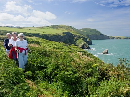
The Ceredigion Coast Path
Ceredigion's 60 miles (96km) Coast Path is a very special part of the Wales Coast Path, with probably the most varied landscape and terrain of the 870 mile (1400km) route. As well as great views north towards Snowdonia and south towards Pembrokeshire, the Ceredigion Coast path has a wealth of wildlife, geological and archaeological features and a colourful history to discover along the way.
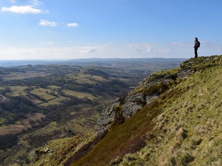
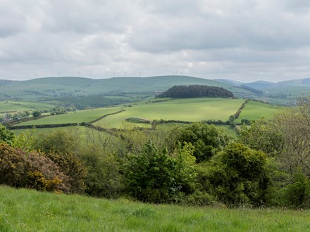
Walking in the Cambrian Mountains
The Cambrian Mountains has a range of walking trails, exploring woods and waterfalls, and the ancient routes of medieval monks, the paths taken by romantic 19th century writers and poets in search of adventure, and the tracks of the hardworking drovers and miners. Find quiet solitude on some of Ceredigion’s more challenging walks, and view the peaks of Snowdonia and the Beacons of south Wales from a different perspective - from the summit of Pumlumon.
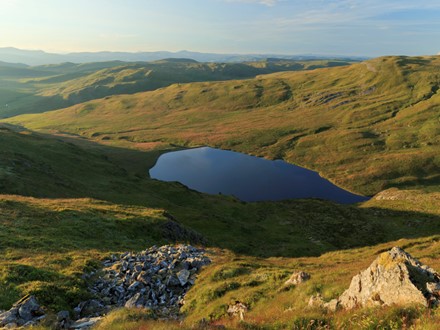
Walk to the summit of Pumlumon (Plynlimon)
Scale the heights of Pumlumon, the highest point in Ceredigion, and discover the lakes and streams that are the source of mighty rivers and enjoy uninterrupted views of the mountain ranges of Wales and Ceredigion's inland landscapes.
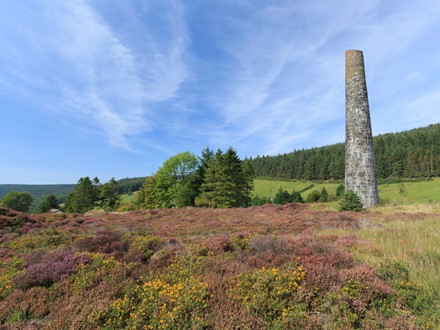
Spirit of the Miners walks
Explore Ceredigion's mining heritage with the Spirit of the Miners walks from the Cardigan Bay coast to the valleys of the Cambrian Mountains. The route, also known as the Mal Evans Way, links Borth, Talybont, Bwlch Nant yr Arian, Devil's Bridge and Pontrhydfendigaid. Circular routes explore individual areas in more detail.
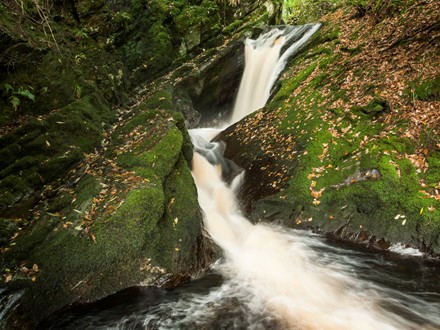
Wilderness escapes: waterfalls, woods and wetland reserves
Ceredigion's countryside is a haven for wildlife with moorland, woodland, rivers and quiet lanes lined with flower filled hedgerows providing great habitats. Simply go for a walk, visit one of our many and varied nature reserves or wildlife centres, or let our local guides and experts show you the best on walks, talks and tours.
Celtic Ceredigion: hillforts and mythical heroes
Standing stones and hill forts are monuments to early man’s settlement of Ceredigion - there are over 170 identified hill forts and enclosures scattered across Ceredigion from the summit of Pumlumon mountain to the Cardigan Bay coast. Many are linked to legends and are great destinations for walks and views.
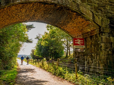
Ystwyth Trail
The Ystwyth Trail is a 20 mile (32km) scenic cycleway, bridleway & footpath route following the Ystwyth river from Aberystwyth before climbing up towards Cors Caron, Pontrhydfendigaid and Tregaron. Substantial off road sections of the trail follow the track of the old Great Western Railway line and are are suitable for families with young children. The complete trail is suitable for experienced cyclists.
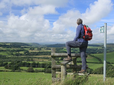
Ceredigion 100 mile challenge
Discover the best of Ceredigion's Public Rights of Way with our selection of circular walks in different parts of Ceredigion.
Start by completing a total of 10 miles with short easy walks (there are wheelchair and baby buggy friendly routes too), build up to 50 and then go on to complete the Ceredigion 100 mile walking challenge.
Walk and Talk Cymraeg
Want to learn or practice some Welsh and love walking?
Why not join one of the regular walks offered by Welsh language walking groups in Ceredigion who go out walking with a mixed group of learners and supportive fluent Welsh speakers. From fluent speakers to learners who are making their first steps in the language, there is a warm welcome to everyone.
