Discover Ceredigion's hidden industrial past by following the route linking the Ceredigion coast at Borth to Devil's Bridge and on to Pontrhydygroes and Pontrhydfendigiad in the Cambrian Mountains.
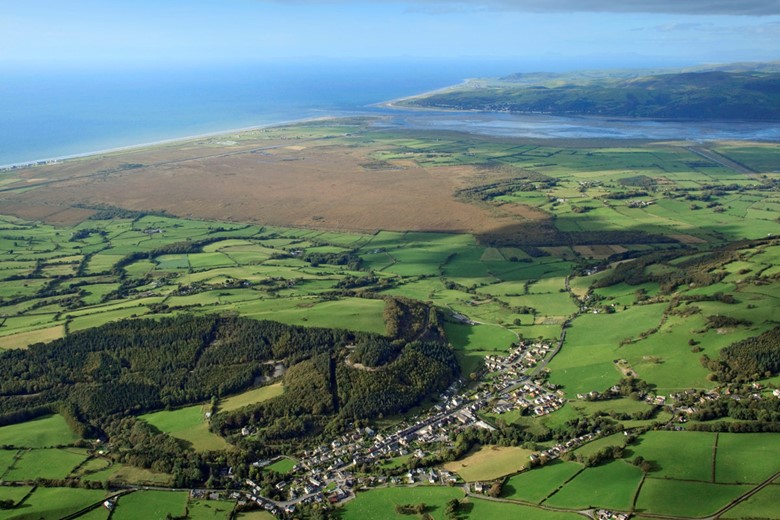
Archaeologists have found evidence of Roman lead smelting sites on the edge of Cors Fochno (Borth Bog) and mining for copper may date back to the Bronze age. From the edge of the bog, the route takes you over the wooded Allt y Crib hill where there are remains of many mine workings.
Large scale mining started in the 17th century when Sir Hugh Myddleton took over the leases for the Society of Mines Royal in 1617. The mines were later worked by Thomas Bushell whose name was given to a level commenced in 1637 and driven for a distance of 200 fathoms. This was to be the main working level of the Allt y Crib mine for the next 200 years.
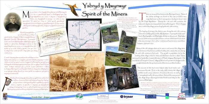
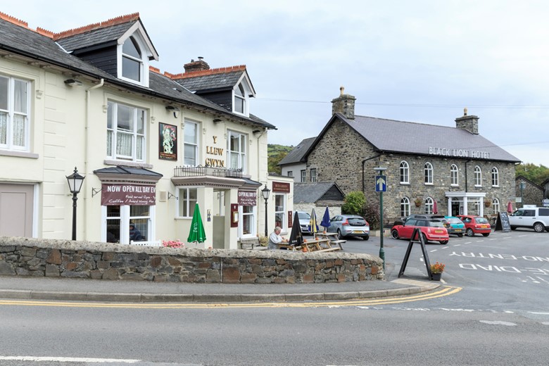
It was the early 19th century that saw the growth in mines and mills at Talybont when the Flintshire Smelting Company drove a deep adit from the centre of Talybont village. This was at a place known as Y Wern which is behind the White and Black Lions pubs in the centre of the village. The Black Lion is the symbol of the Gogerddan estate, who had extensive mineral rights in the area. Look out for the information panels along the route with images of miners, the undergrounds works.
Local miners worked in a number of lead and copper mines in the area. Some men made the long trek to Esgairhir mine, nearly 10km to the east. During the week, most would live at the mine barracks, returning home on Saturday evenings to collect their pay at the Black Lion Inn and spend Sundays at home.
From Talybont the route climbs gently toward Bontgoch Elerch, partly following the track of the Plynlimon & Hafan Tramway, built to serve the lead mines and quarries in the hills east of Tal-y-bont.
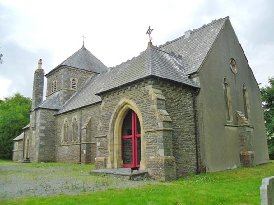
The route then descends through woodland to Bontgoch - Elerch, crossing the Leri river over a footbridge near Plas Cefn Gwyn. Once a busy centre for the lead miners who worked the mines in the surrounding hills, the village boasts striking buildings, designed by eminent Victorian architects. St Peter’s Church was designed by William Butterfield for the Rev. Lewis Gilbertson, Vice-principal of Jesus College, Oxford, whose family lived at Plas Cefn Gwyn.
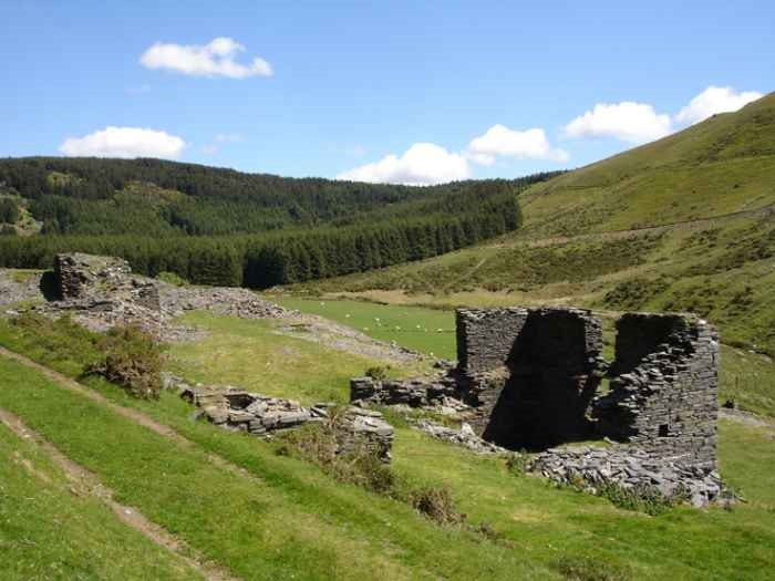
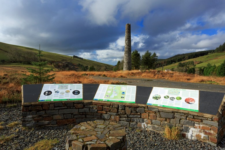
From Bontgoch the route traverses the slope of Banc Llechwedd Du towards Llety Ifan Hen and Blaencastell before descending towards Cwmsymlog. A restored mine chimney dominates the landscape but everywhere around are traces of mining, as well as a chapel, miners cottages and the mine managers house. Mining spoil piles are slowly being reclaimed by nature with gorse bushes and rare ferns.
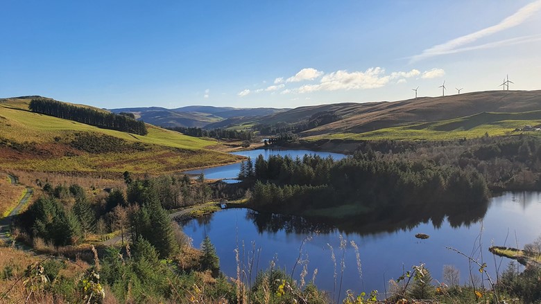
Above Cwmsymlog are a number of small reservoir ponds: Llyn Pendam, Llyn Blaenmelindwr and Llyn Rhosgoch. Yo are quite likely to see mountain bikers along the tracks and the single track road that passes by the lakes. This is a sign that you are nearing the Bwlch Nant yr Arian centre.
Bwlch Nant yr Arian to Devil's Bridge
Bwlch Nant yr Arian appropriately means 'the gap of the silver stream'. The Centre is a perfect spot to break your journey as it has a cafe that overlooks the lake where you can watch red kites being fed in the afternoon. Nearby is the Silver Mountain Experience at Llywernog mine.
Once you have (carefully) crossed the A44 you skirt round the wind turbines and head down towards Llyn yr Oerfa and the mining village of Ystumtuen, tucked between the hills and open moorland to the north, and the steep wooded valley of the Rheidol to the south and east. Mine working had begun around Ystumtuen since at lest the early 18th century,had mine spoil heaps. Spoil heaps dominate the landscape and the stone cottages which were once the miners' homes. As you leave the village You will pass a chapel, originally built for Cornish mineworkers who had come to the area to work.
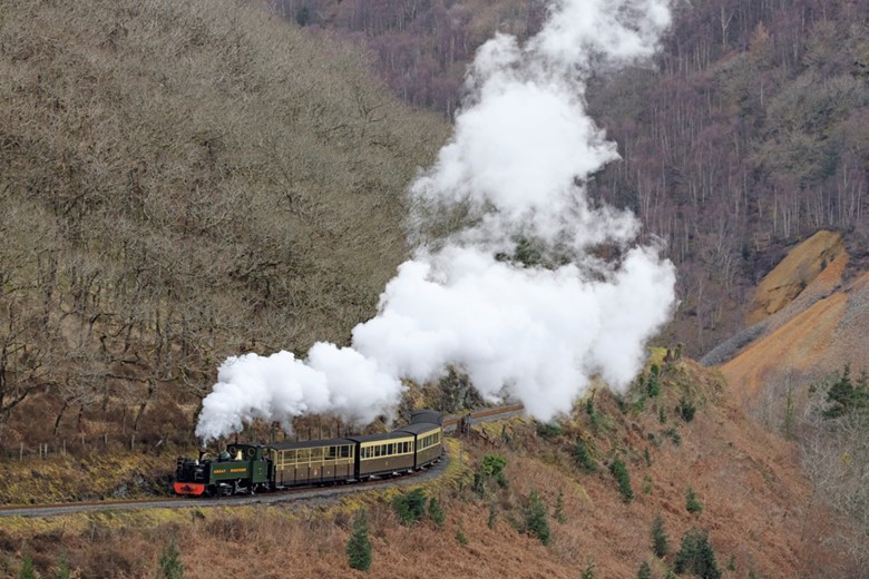
You can see your destination - Devil's Bridge across the Rheidol valley, but first you have to descend to the valley floor through the woods. If you time things well, you'l see the Vale of Rheidol train patiently puffing along the curves of the hillside on the opposite side of the valley.
After crossing the river over a footbridge the path continues through woodland to reach the railway track. the path then continues alongside the railway for a little while before turning away through woodland and across a couple of fields to finally approach the village of Devil's Bridge.
Devil's Bridge to Pontrhydygroes and Pontrhydfendigaid
Between Devil's Bridge and Cwmystwyth you will reach the highest point on the route before reaching the dramatic mining landscape of Cwm Ystwyth and the forest estate of Hafod.
Pontrhydygroes retains many features of its mining past which are worth seeking out before ascending to the open moorland and Banc Esgair Mwyn ridge, continuing to Ffair Rhos and the hillfort of Pen y Bannau overlooking Strata Florida abbey.
The monks of Strata Florida were miners and farmers as well as scribes. Follow the Teifi river to the edge of Cors Caron (Tregaron bog) to join the Ystwyth Trail. You can follow the Ystwyth Trail to Aberystwyth or continue to Tregaron.